Registration rates:
$20 for AMS student members
$35 for AMS members
$55 for non-members
The American Meteorological Society, partnering with NOAA (National Oceanic and Atmospheric Administration), will be hosting this hybrid short course at the Collective Madison Meeting in Madison, Wisconsin at the Monona Terrace (for in-person participants). The short course will provide participants an opportunity to use readily available tools to process, display, and analyze GOES-R, JPSS, and other environmental satellite data products in lake application scenarios.
| Registration close date: | Thursday, August 4, 2022 at 11:45 PM Eastern |
| Participant cap: | 50 |
Registration rates:
$20 for AMS student members
$35 for AMS members
$55 for non-members
Registration policy:
Refunds will not be issued to attendees within 7 days of the start of a course. Registrations are not transferable or exchangeable.
This short course will provide participants an opportunity to use readily available tools to process, display, and analyze GOES-R, JPSS, and other environmental satellite data products in lake application scenarios. The participants will learn how satellite observations and other data products are applied to a variety of lakes, ranging through different lake widths/depths, tropical and mid/higher latitude lakes, as well as winter and summer examples. Satellite subject matter experts will lead hands-on exercises using regional lake case studies and provide participants an opportunity to produce imagery and analyze data such as lake surface water temperature, algal blooms, meteotsunamis, snow/ice, and convection initiations and thunderstorms over the lakes.
Participants will need access to Zoom through either the web or desktop application (if participating virtually).
CIMSS
Scott Lindstrom is an Information Technologist and trainer at the Cooperative Institute for Meteorological Satellite Studies (CIMSS) at the University of Wisconsin-Madison. The best part of his job is looking at beautiful satellite imagery every day and describing how its use can help in the forecast process. This is done both in writing on blogs and in training webinars. He holds a B.S. in Meteorology (and one in Computer Science) from Penn State, and an M.S. and Ph.D. in Meteorology from the University of Wisconsin-Madison.
Universidade de São Paulo
Dr. Rachel Ifanger Albrecht is a professor at the Department of Atmospheric Sciences at the University of São Paulo where she leads a group of graduate and undergraduate students in cloud physics and atmospheric electricity. Her research and teaching interests include the physics of lightning and precipitation, cloud-aerosol-precipitation interactions in deep convection, and remote sensing of precipitation and lightning to improve short-term forecasting of severe storms.
GLERL
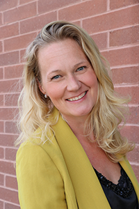
Andrea Vander Woude, PhD, is a satellite oceanographer, data scientist, and geologist. She has been using remote sensing for over 20 years and specifically hyperspectral imagery for more than 5 years to understand ecological and physical processes in the Great Lakes and the coastal and Southern Ocean.
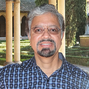
NOAA/NESDIS JPSS
Dr. Satya Kalluri is the chief of the Satellite Meteorology and Climatology Division at NOAA/NESDIS/STAR and is the program scientist for the JPSS mission. Dr. Kalluri has more than 30 years of experience in applying satellite data for a variety of applications as well as in developing new mission concepts and algorithms for end to end processing of satellite data. He received his Ph.D. in Geography from University of Maryland at College Park in 1994.
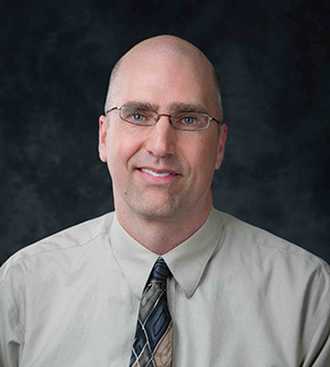
NOAA/NESDIS GEO
Dr. Andrew Heidinger is the current NESDIS GEO Senior Scientist and is working mainly in support of GeoXO. He previously worked at NESDIS STAR and led the Cloud Science Team. His research has included algorithm development, radiative transfer modeling, sensor calibration and satellite climate analysis.
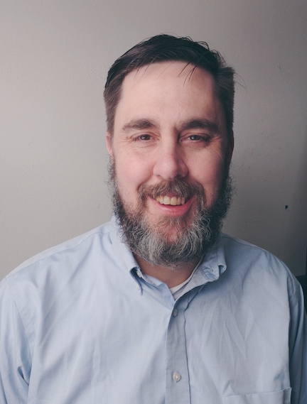
Advanced Satellite Products Branch
Mark joined NESDIS/STAR in December 2018 as a scientist within the Advanced Satellite Products Branch stationed in Madison, WI. Over the course of his career, he has served as a Principal Investigator, Co-Investigator, and Collaborator on numerous NOAA, NASA, and NSF projects, including stints on the NASA Precipitation Measurement Missions and CloudSat/CALIPSO science teams. His primary scientific research interests include developing and improving quantitative precipitation estimates of falling snow using ground-based and satellite remote sensing observations, creating satellite-based snowfall nowcasting tools, and Great Lakes snowfall.